1047 Richmond Rd.#
Last updated: 2026-06-19 · ID: D07-12-24-0104
Summary#
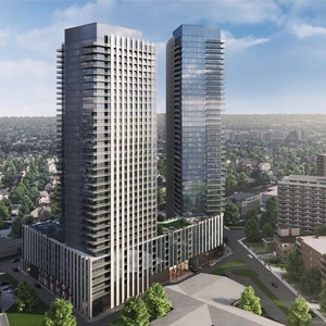
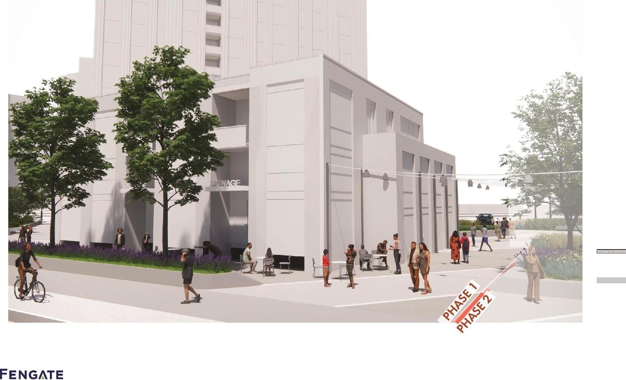
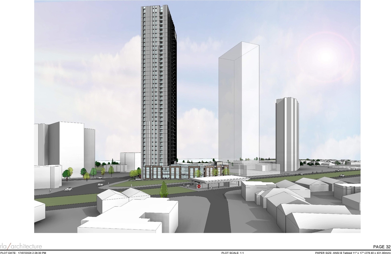
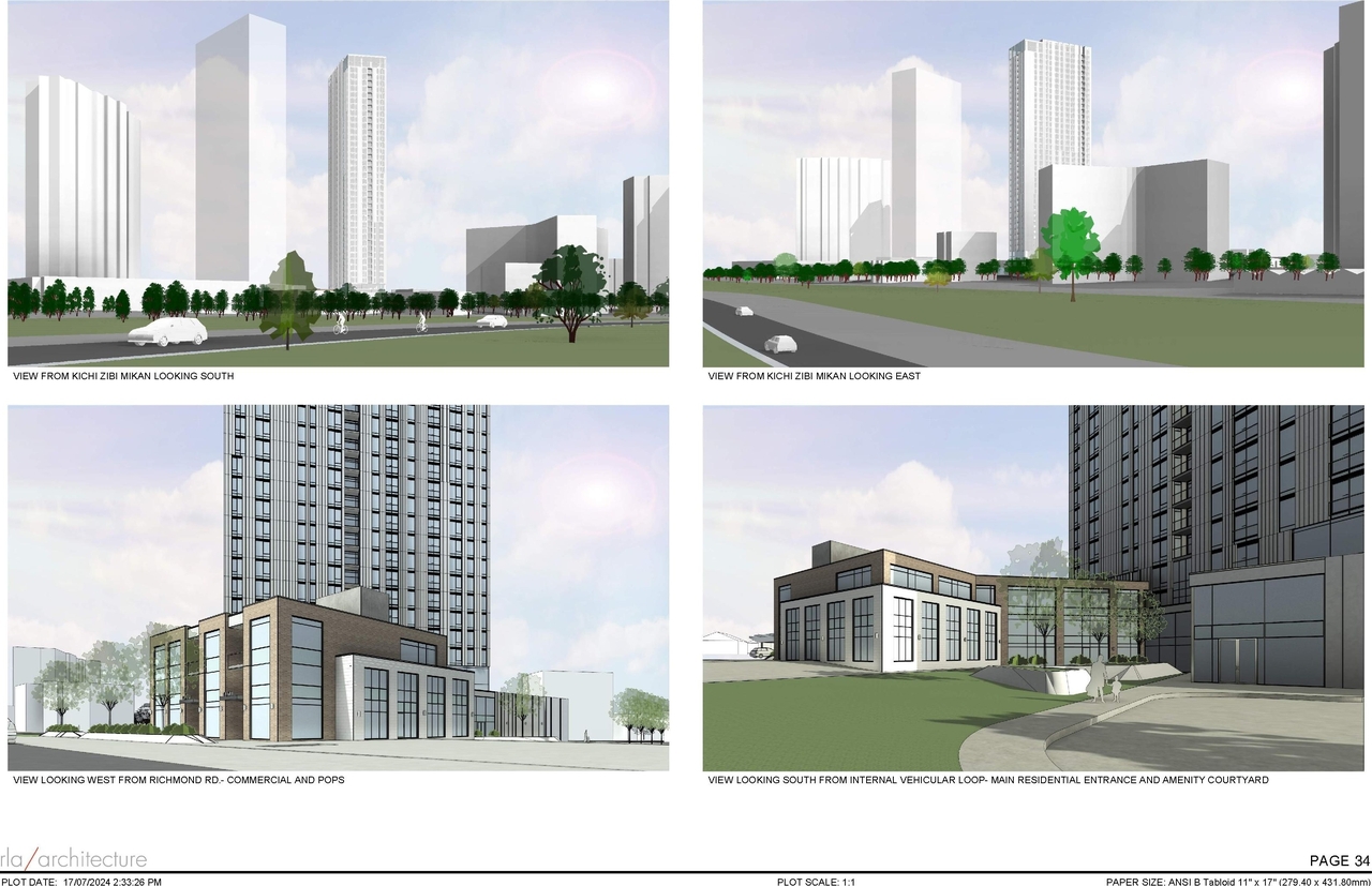
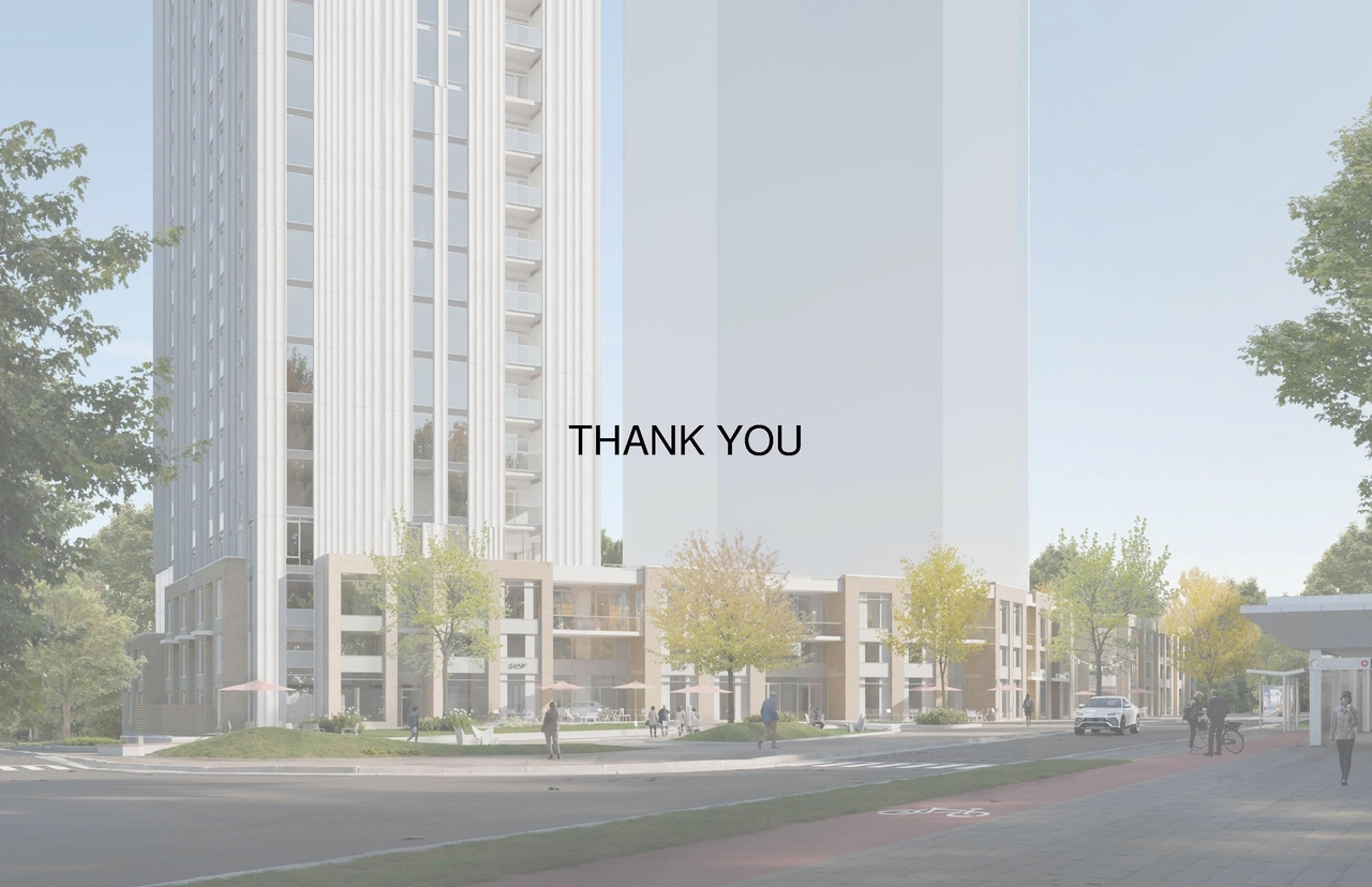
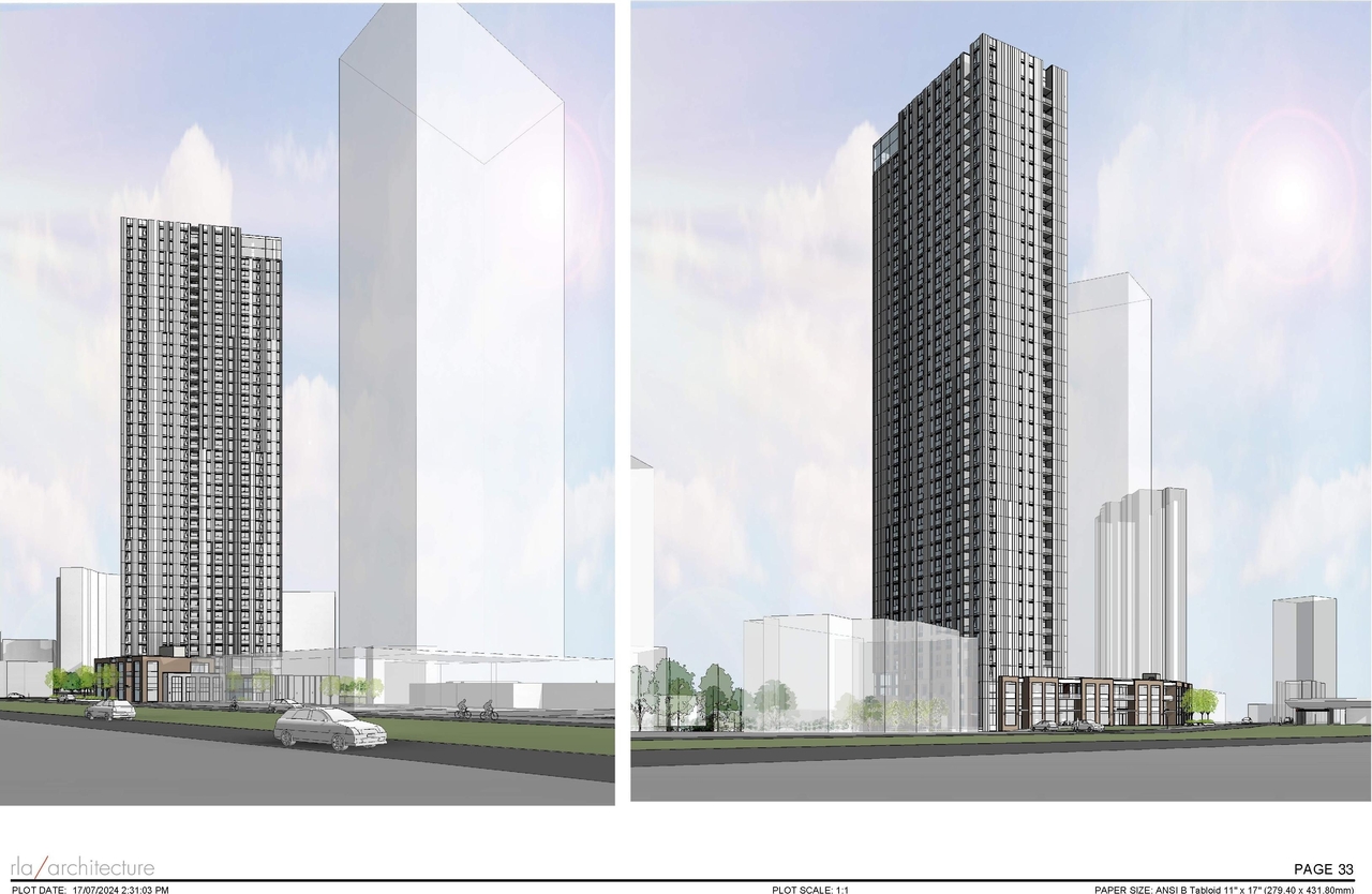
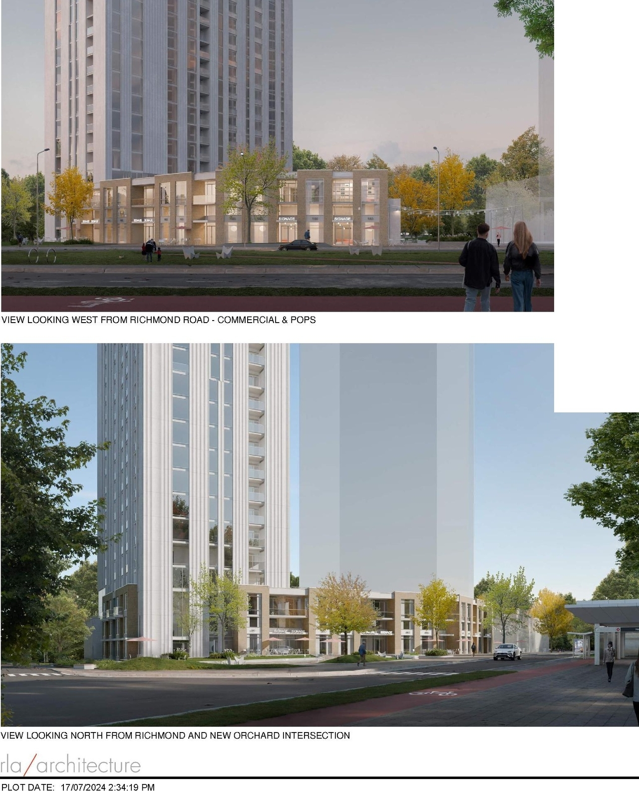
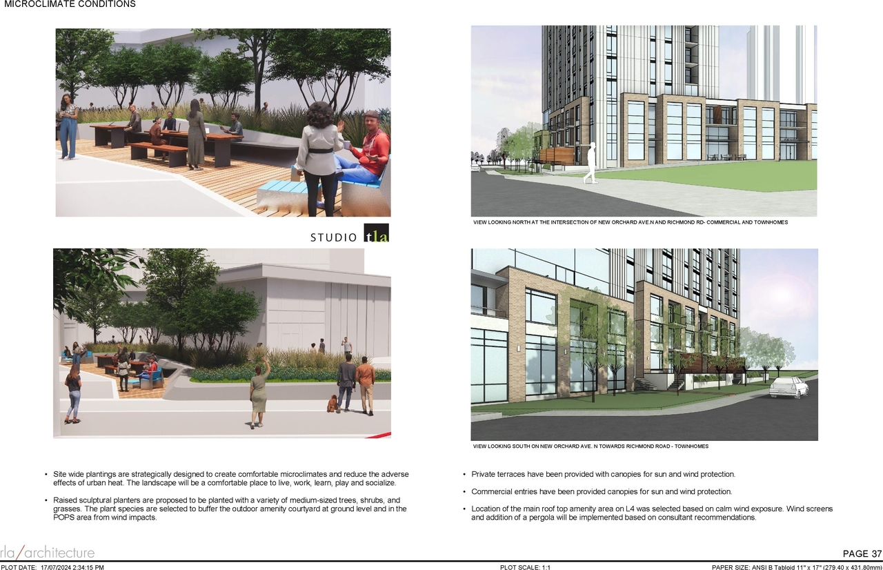
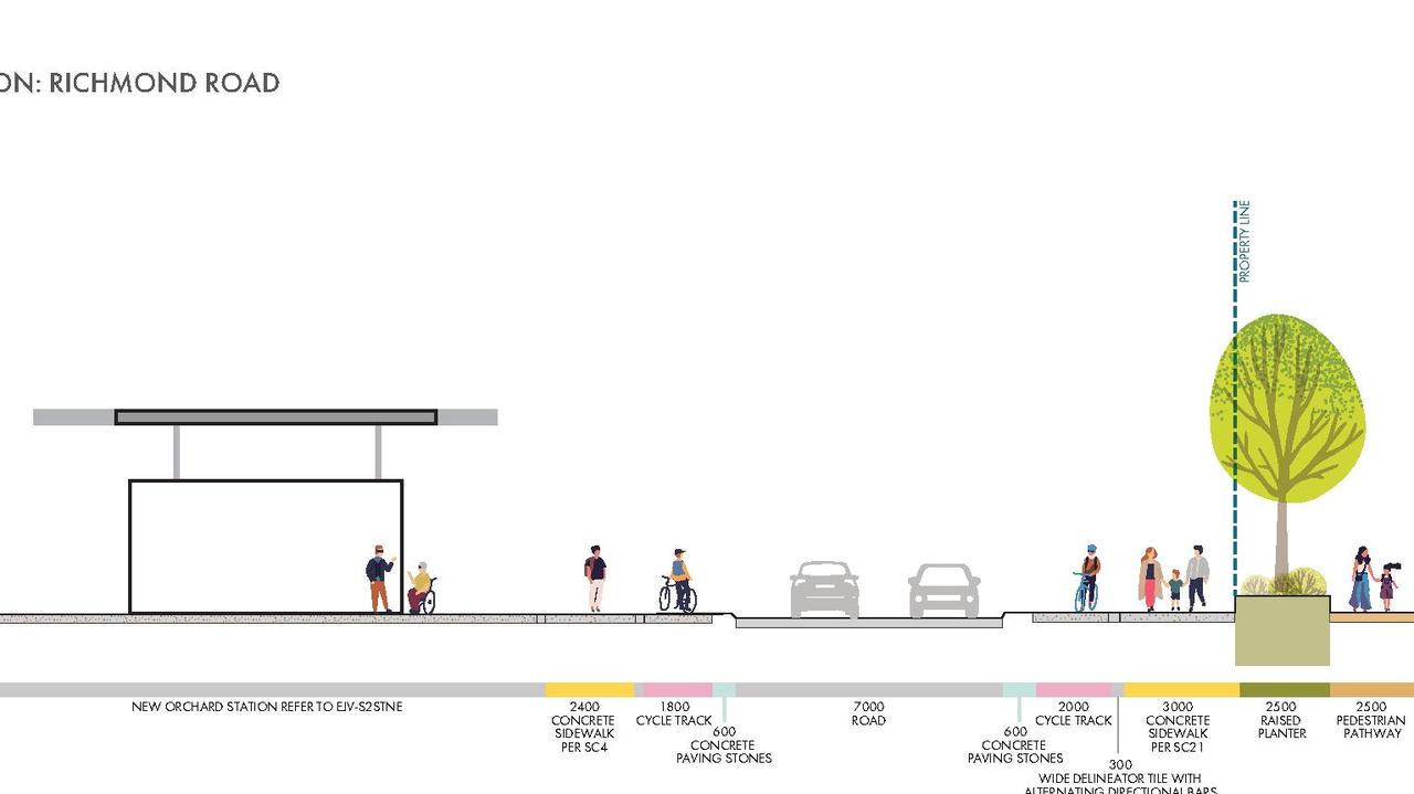
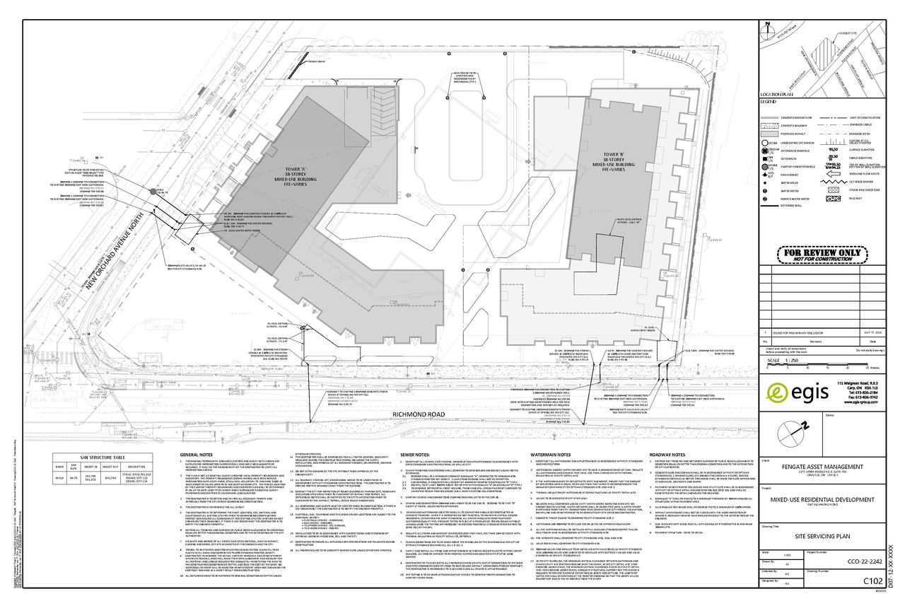
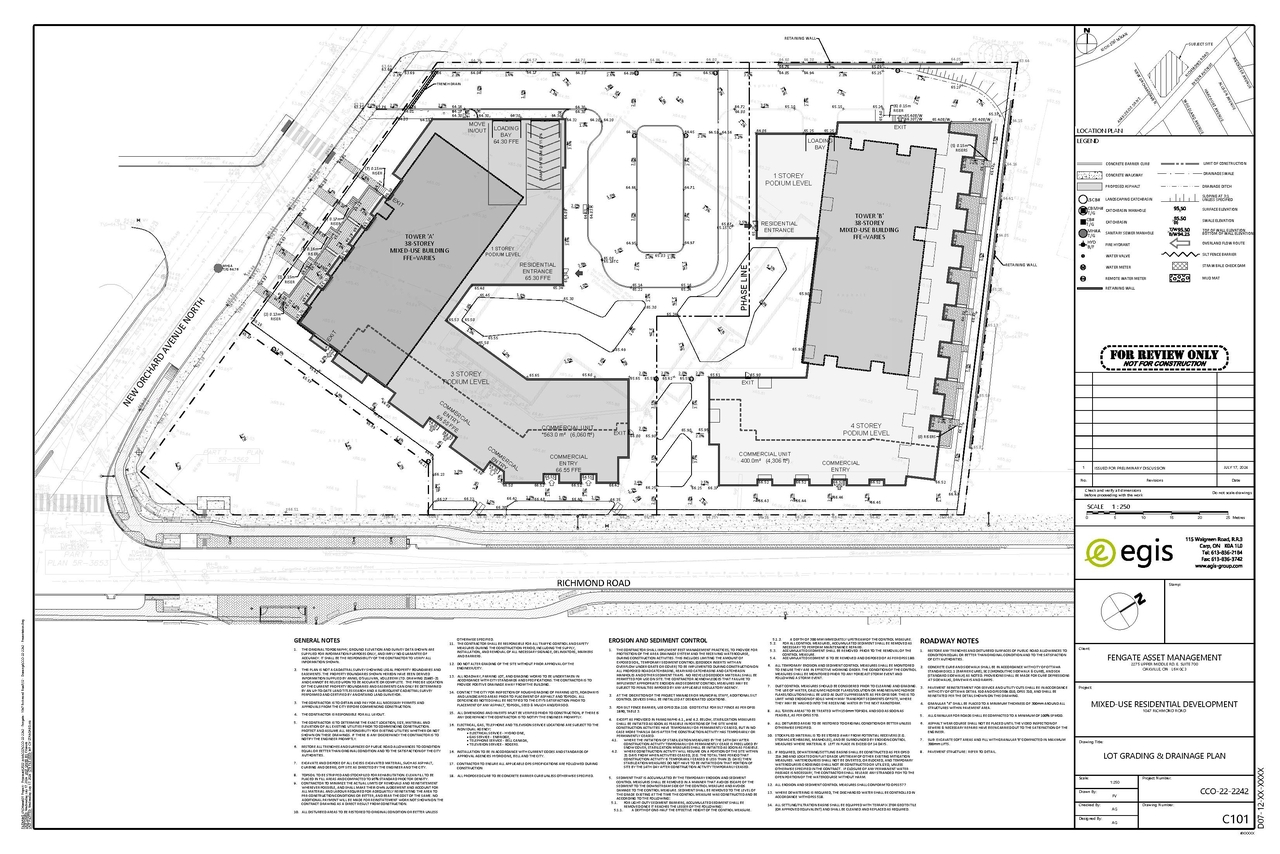
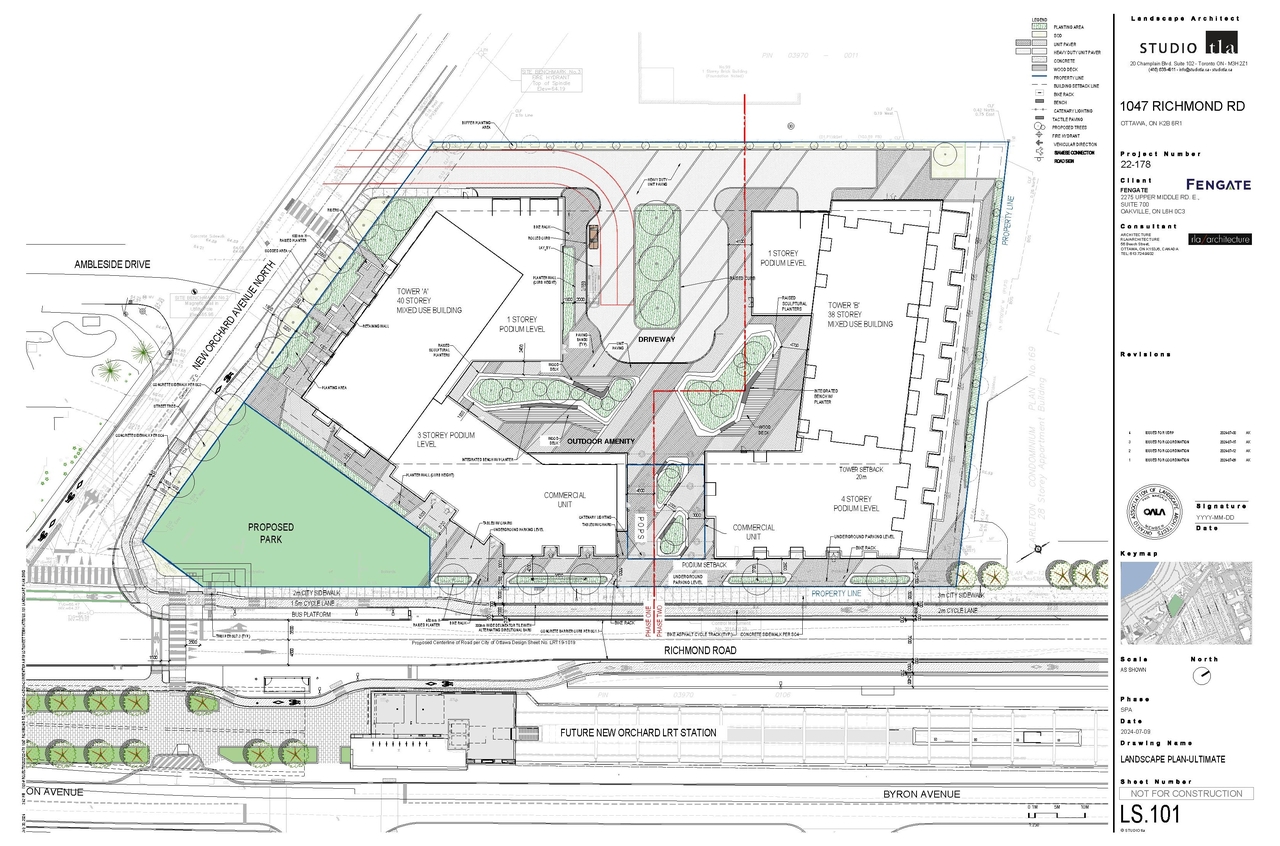
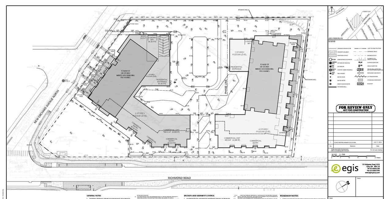
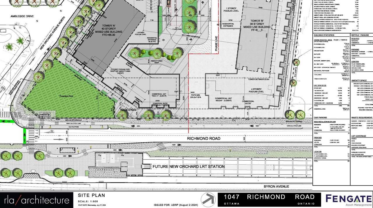
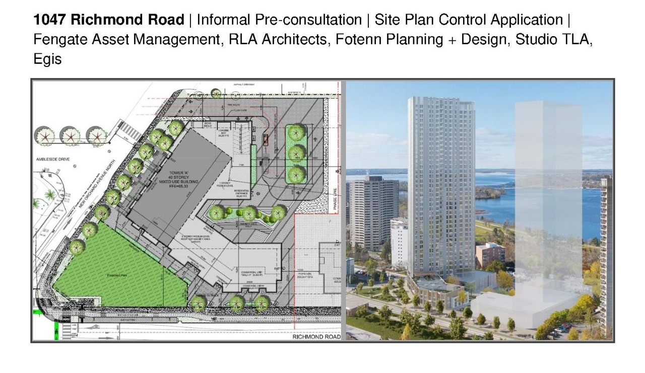
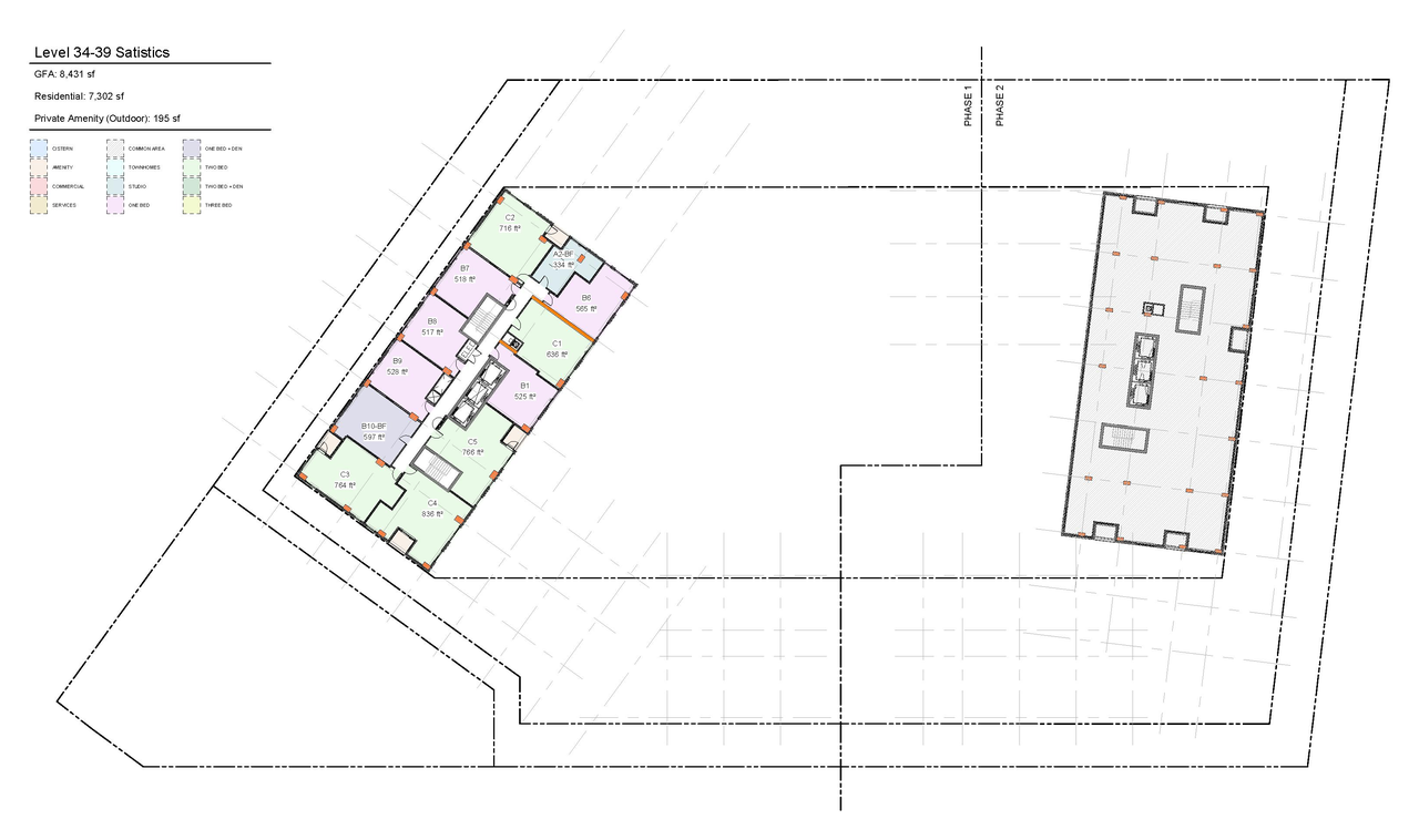
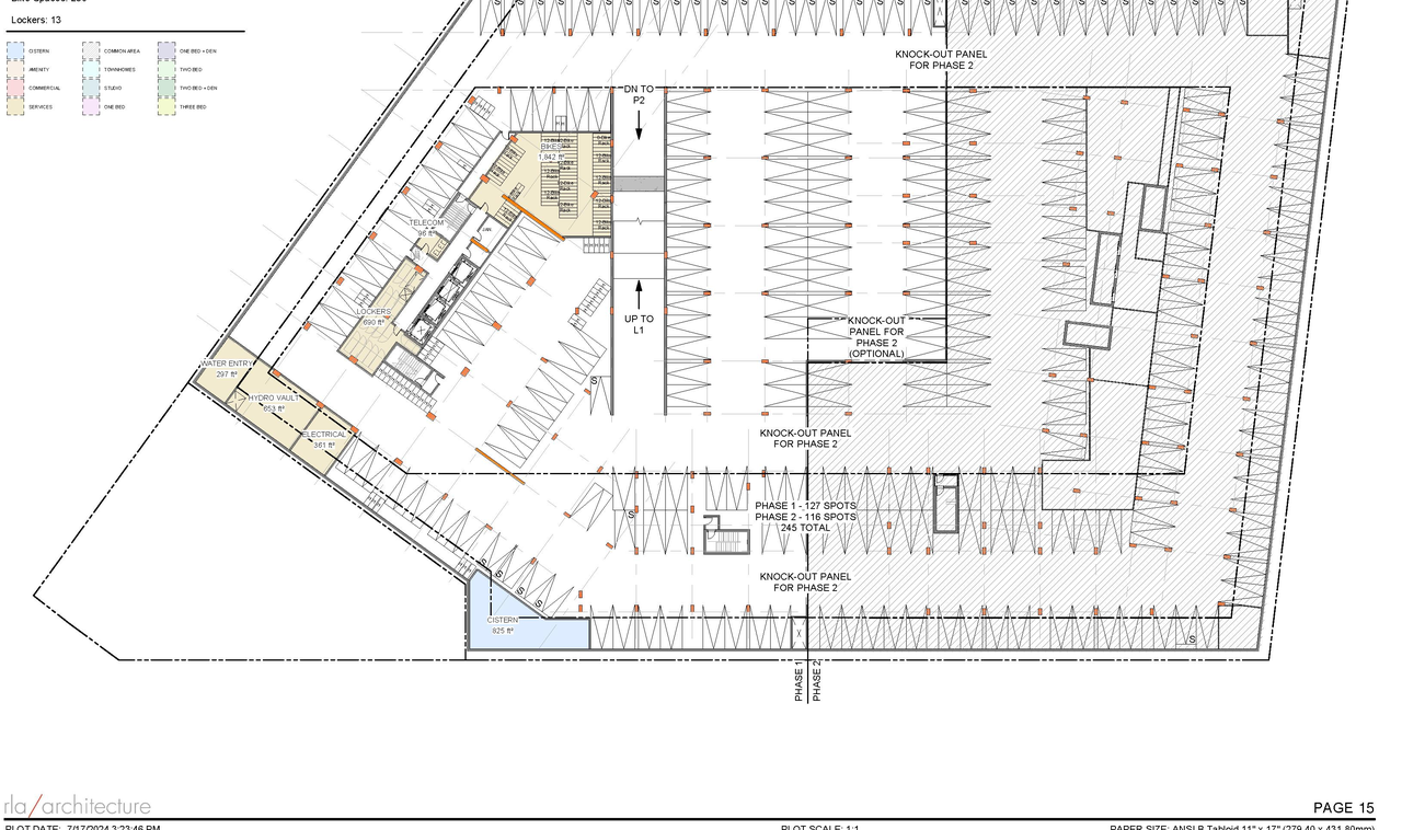
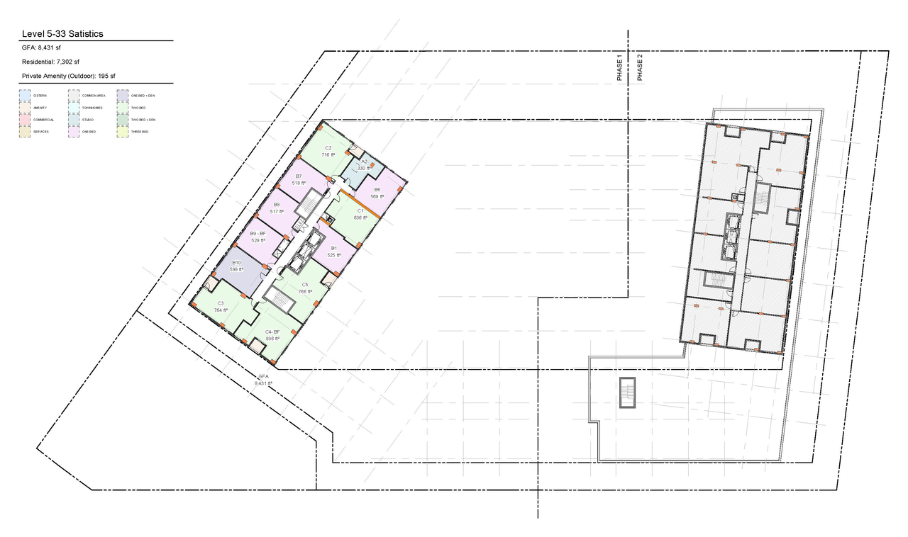
A Site Plan Control application to construct Tower A (Phase 1), a high-rise mixed-use building with underground parking, and to provide parkland. The proposed development includes 423 residential units, 497.7 square metres of commercial space, 254 vehicle parking spaces and 528 bicycle parking spaces.
Status
Post Approval (Receipt of Agreement from Owner Pending)
Post Approval (Receipt of Agreement from Owner Pending)
Type
Site Plan Control
Site Plan Control
Building Scale (Max.)
Based on elevation drawings. Values may be approximate. See sources for exact figures.
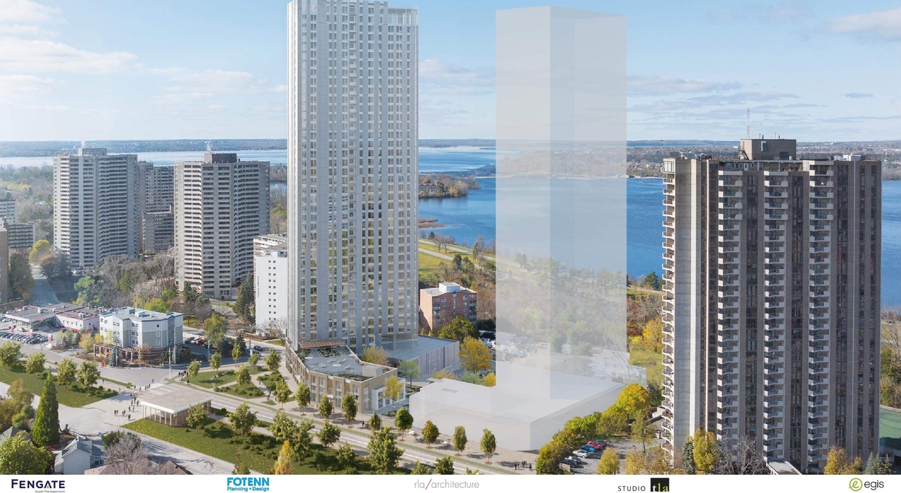
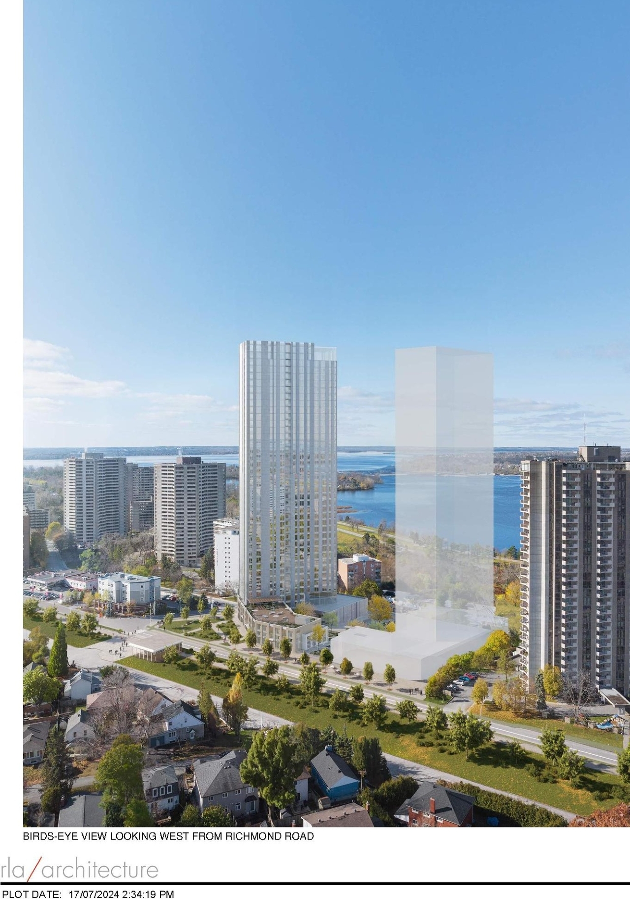
High-rise · 36 storeys
· 116.99 m
Renders#

Location#
Select a marker to view the address.
Project Updates#
Status Updated
- Status: Post Approval (Receipt of Agreement from Owner Pending)
Added 1 document
Status Updated
- Status: Post Approval (Request for Agreement Received)
Added 16 documents
- Status: Inactive (Notice of Decision Sent)
- 2025-09-22 - APPROVED Tree Conservation Report - D07-12-24-0104
- 2025-09-22 - APPROVED Transportation Noise and Vibration Assessment - D07-12-24-0104
- 2025-09-22 - APPROVED Transportation Impact Assessment - D07-12-24-0104
- 2025-09-22 - APPROVED Site Servicing Plan - D07-12-24-0104
- 2025-09-22 - APPROVED Site Servicing and SWM Report - D07-12-24-0104
- 2025-09-22 - APPROVED Site Plan Approval Report - D07-12-24-0104
- 2025-09-22 - APPROVED Site Plan - D07-12-24-0104
- 2025-09-22 - APPROVED Phase Two Environmental Site Assessment - D07-12-24-0104
- 2025-09-22 - APPROVED Phase One Environmental Site Assessment - D07-12-24-0104
- 2025-09-22 - APPROVED Pedestrian Level Wind Study - D07-12-24-0104
- 2025-09-22 - APPROVED Lot Grading and Drainage Plan - D07-12-24-0104
- 2025-09-22 - APPROVED Landscape Plans - D07-12-24-0104
- 2025-09-22 - APPROVED Geotechnical Assessment Report - D07-12-24-0104
- 2025-09-22 - APPROVED Elevations - D07-12-24-0104
- 2025-09-22 - APPROVED Dewatering Assessment - D07-12-24-0104
- 2025-09-22 - APPROVED Confederation Line Level 2 Proximity Study - D07-12-24-0104
Added height and 8 documents
- Height: 116.99 m
- Storeys: 36 storeys
- 2025-09-05 - Site Plan - D07-12-24-0104
- 2025-09-05 - Revised Site Servicing Plan - D07-12-24-0104
- 2025-09-05 - Revised Lot Grading & Drainage Plan - D07-12-24-0104
- 2025-09-05 - Revised Landscape Package - D07-12-24-0104
- 2025-09-05 - Phase Two Environmental Site Assessment - D07-12-24-0104
- 2025-09-05 - Phase One Environmental Site Assessment - D07-12-24-0104
- 2025-09-05 - Elevations - D07-12-24-0104
- 2025-09-05 - Dewatering Assessment - Proposed Excavation - D07-12-24-0104
Added 7 documents
- 2025-07-04 - Site Servicing Plan - D07-12-24-0104
- 2025-07-04 - Site Plan Phase 1 - D07-12-24-0104
- 2025-07-04 - Servicing Report - D07-12-24-0104
- 2025-07-04 - Landscape Plans and Details - D07-12-24-0104
- 2025-07-04 - Hydrogeological Investigation - Excavation - D07-12-24-0104
- 2025-07-04 - Grading, Drainage, Erosion & Sediment Control Plan - D07-12-24-0104
- 2025-07-04 - Geotechnical Report - D07-12-24-0104
Status Updated
- Status: Active (Application Reactivated)
Added 9 documents
- 2025-04-22 -SITE SERVICING PLAN - D07-12-24-0104
- 2025-04-22 -SITE PLAN - D07-12-24-0104
- 2025-04-22 - Transportation Impact Assessment Report FINAL - D07-12-24-0104
- 2025-04-22 - SITE SERVICING & STORMWATER MANAGEMENT
- 2025-04-22 - LOT GRADING, DRAINAGE, EROSION AND SEDIMENT CONTROL PLAN PLAN - D07-12-24-0104
- 2025-04-22 - Landscape Plan - D07-12-24-0104
- 2025-04-22 - Gradient Wind Addendum V2 - D07-12-24-0104
- 2025-04-22 - Geotechnical Assessment Report - D07-12-24-0104
- 2025-04-22 - DEWATERING ASSESSMENT, PROPOSED
Status Updated
- Status: Active (Additional Submission Circulation Period Completed)
Status Updated
- Status: Active (Application Reactivated)
Added 8 documents
- 2024-12-19 - Transportation Impact Assessment Report - D07-12-24-0104
- 2024-12-19 - Site Servicing Plan - D07-12-24-0104
- 2024-12-19 - Site Servicing and Stormwater Managment Report - D07-12-24-0104
- 2024-12-19 - Site Plan - D07-12-24-0104
- 2024-12-19 - LOT GRADING AND DRAINAGE - EROSION AND SEDIMENT CONTROL PLAN - D07-12-24-0104
- 2024-12-19 - Landscape Drawing Set - D07-12-24-0104
- 2024-12-19 - GEOTECHNICAL ASSESSMENT REPORT - D07-12-24-0104
- 2024-12-19 - Confederation Line Level 2 Proximity Study - D07-12-24-0104
Status Updated
- Status: Active (Initial Review Comments Sent)
Status Updated
- Status: Active (Initial Circulation Period Completed)
Added 1 document
Status Updated
- Status: Active (On Circulation; Initial Submission Review)
Added 1 document
Added description, 30 images and 1 document
- Status: Active (Community Heads Up - supporting documents to be posted later during circulation period)
- A Site Plan Control application to construct Tower A (Phase 1), a high-rise mixed-use building with underground parking, and to provide par…
- 11 renders
- 8 site plans
- 7 elevations
- 4 floor plans
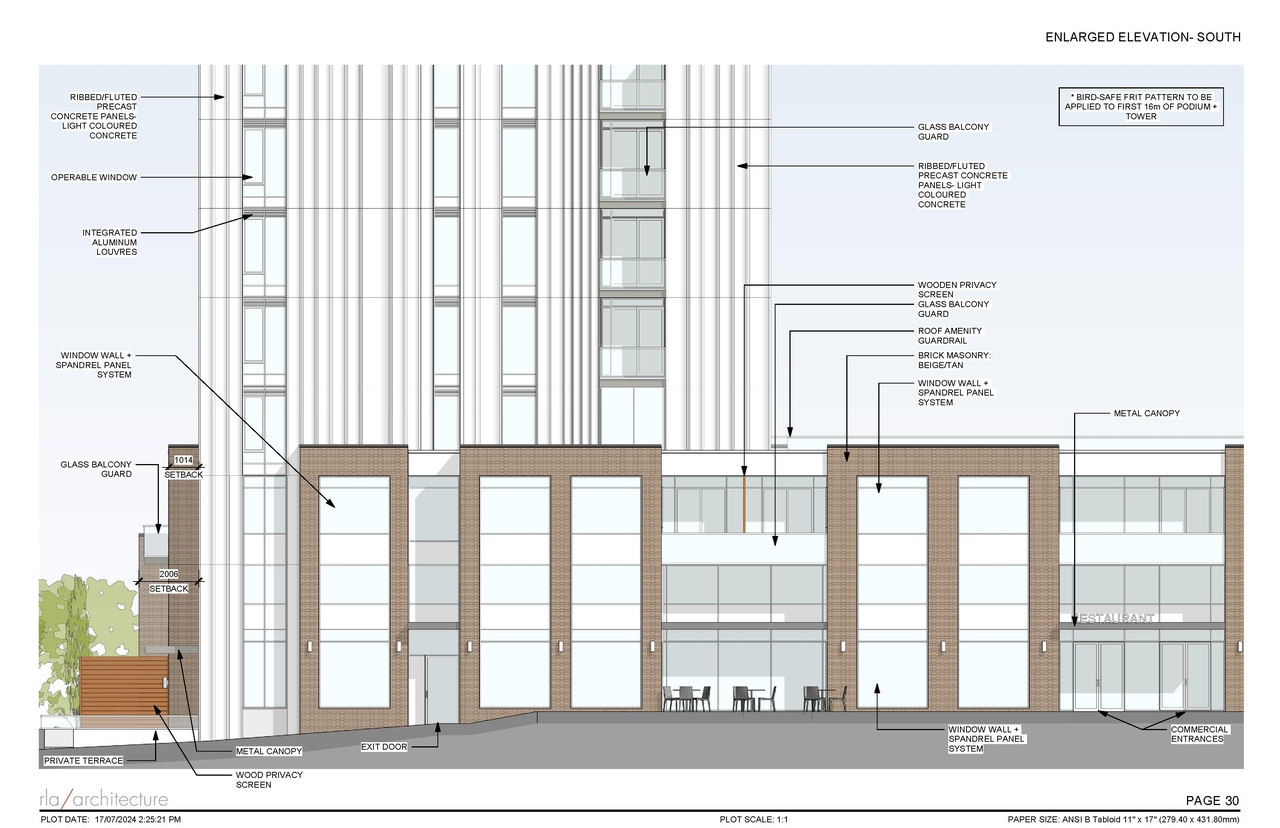
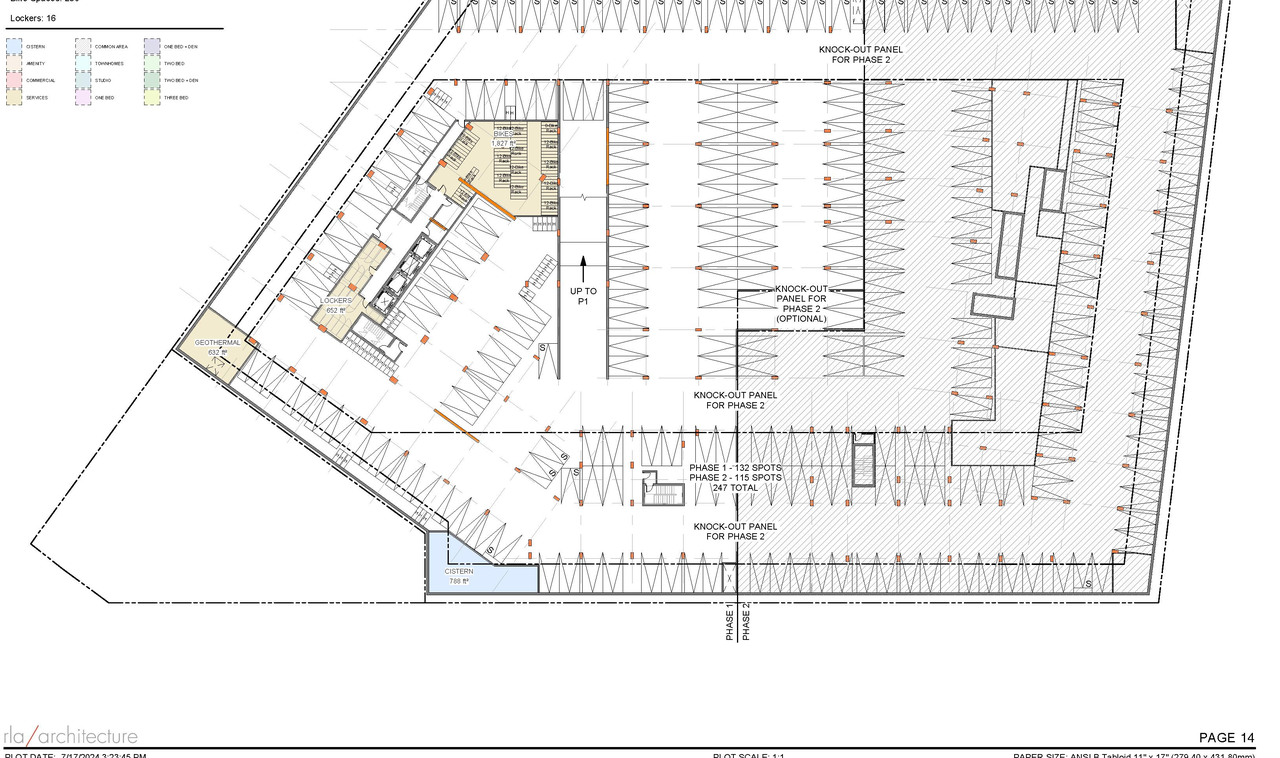
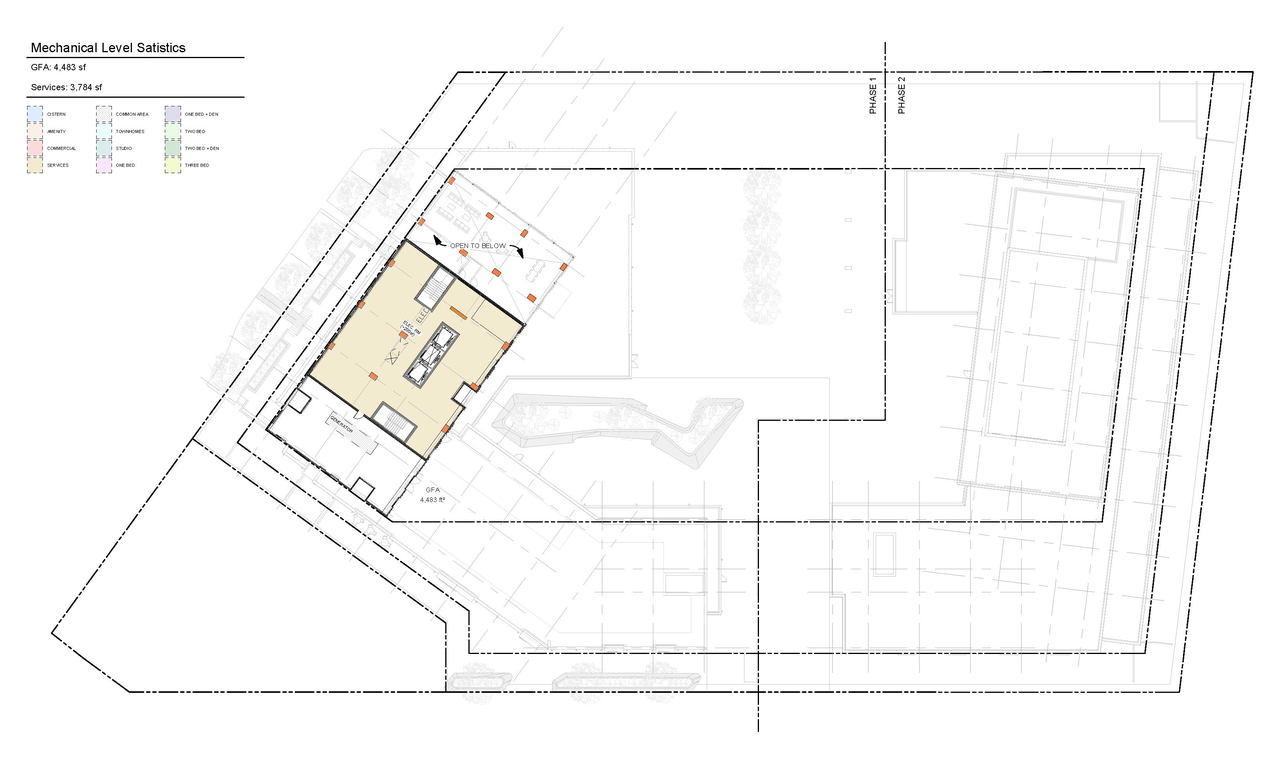
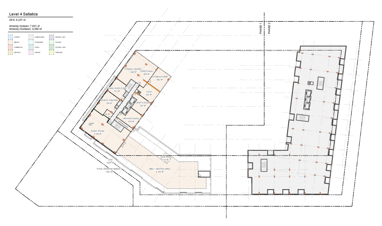
Site Plans, Elevations and Floor Plans#

Additional Information#
| Date Initiated | 2024-09-06 |
| Ward | Ward 7 - Theresa Kavanagh |